Back to Vision
YOU ARE HERE:Project Lagoon Operations
CONSERVATION IN ACTION

We Don't Just Clean the Water.
We Find What the Water Hides.

Project Lagoon is envisioned as a technology-assisted conservation system that combines underwater survey, field observations, data, targeted recovery and verification to better understand and remove submerged debris from the Indian River Lagoon.

Instead of sending crews out to search blindly, the goal is to identify where problems are, document what is found, prioritize recovery and return afterward to verify the results.

Project Lagoon capabilities shown here represent the long-term operational vision and may include equipment, systems and facilities that are proposed, planned or dependent on future funding and partnerships.

SEE HOW IT WORKS
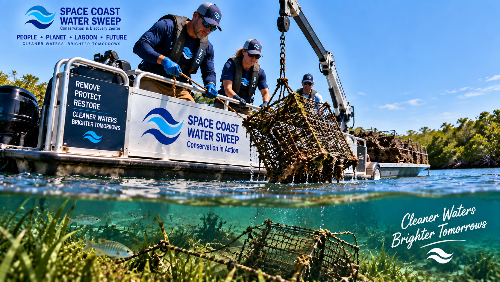
Space Coast Water Sweep team recovering a derelict crab trap from the Indian River Lagoon, lifting a barnacle-encrusted wire trap from the water with a hydraulic crane on a pontoon boat.
VOLUNTEER & EVENTS DISPLAY

Find Your Next Conservation Mission.

A prominent large digital screen in an appropriate public or arrival area of the future Center will eventually be powered by the SCWS event and app system. It can show a filtered selection of events SCWS wants to highlight.

Visitors could eventually find their next conservation mission through QR or touchscreen registration and details. For now, the physical exhibit and display concept is established.
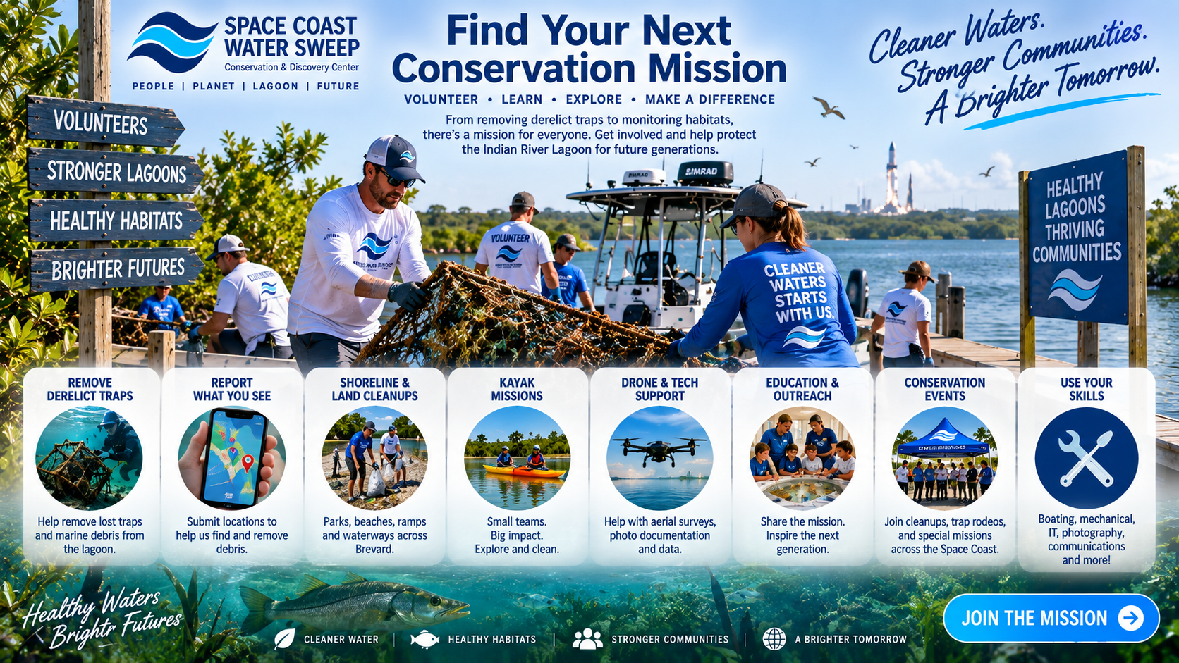
Find Your Next Conservation Mission — Space Coast Water Sweep flyer with volunteers on the lagoon, eight mission categories (remove derelict traps, report what you see, shoreline & land cleanups, kayak missions, drone & tech support, education & outreach, conservation events, use your skills), and a Join the Mission call to action.
Land Cleanups
Water Cleanups
Volunteer Boat/Kayak Events
Crab-Trap Removal
Closed-Season Events
Partner Organization Events
Special Conservation Events
VISIT→LEARN→PARTICIPATE→VOLUNTEER→RETURN

Look, don't touch active legal gear.

Legal active fishing and crabbing gear is not debris. Volunteers are trained to recognize and respect active legal gear.

01 — THE PROBLEM

Some of the Biggest Problems Are the Ones You Can't See.

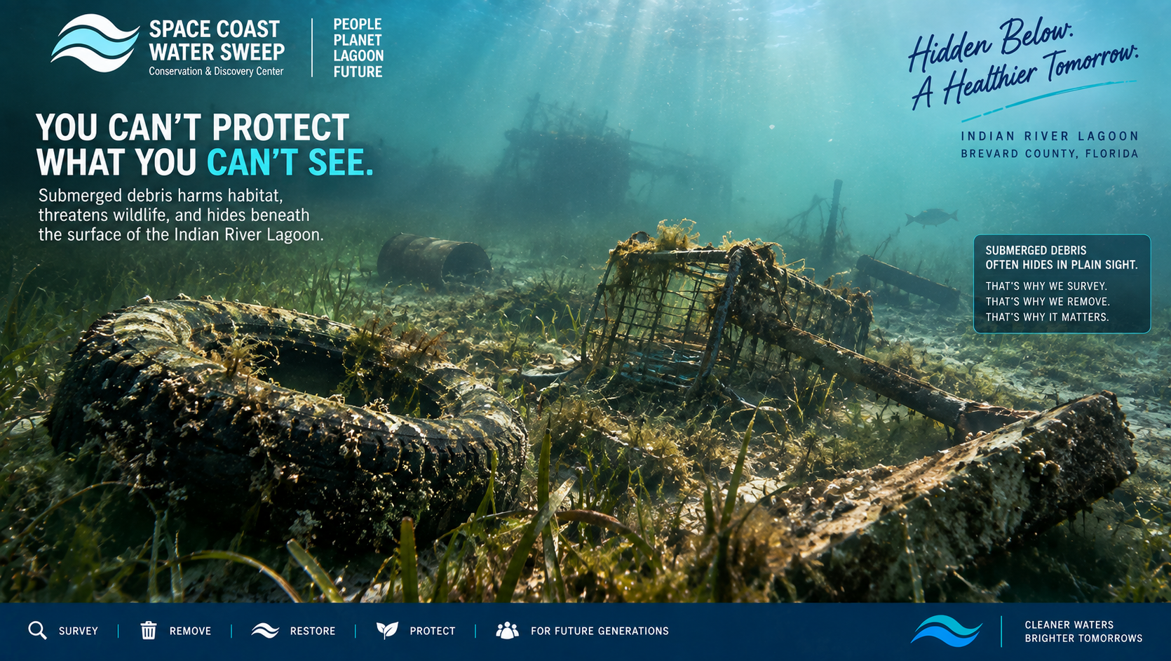
Marine debris can settle below the surface, move with storms and currents, become entangled in habitat, create navigation hazards and remain hidden from normal shoreline cleanups.

Recovery decisions depend on authorization, safety, environmental impact, ownership/legal status, size, condition, access, and permitting or specialty requirements where applicable.
Derelict fishing and crab gear
Submerged debris
Partial vessel debris
Tires where appropriate
Metal
Plastics
Abandoned equipment
Storm-related debris
Other recoverable material identified through authorized operations
Conceptual underwater rendering of submerged marine debris resting on the bottom of the Indian River Lagoon, partially hidden by low visibility and habitat, illustrating why underwater survey technology is needed.
02 — SURVEY

Hidden Waters Helps Turn the Unknown Into a Map.

Hidden Waters is the survey and observation layer supporting Project Lagoon. Survey crews document where they travel and where potential targets are observed.

This is a future operating vision. Not every technology is implied to be already deployed at full scale.
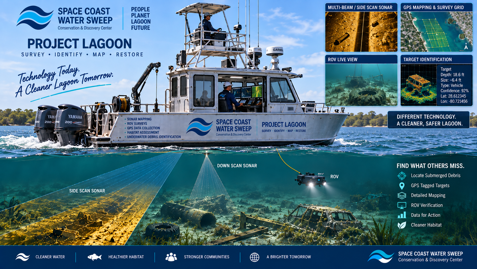
Sonar
Side imaging
Down imaging
Live sonar
GPS tracks
Mapping
ROV observations
Drone observations where appropriate
Field photos
Tablets / mobile data collection
Trained human observation
Conceptual Project Lagoon survey vessel operating a systematic search pattern with sonar displays, GPS mapping and field tablets while identifying submerged targets beneath the Indian River Lagoon.
03 — DETECT

One Tool Doesn't See Everything.

Different tools can complement one another to build a more complete picture of what lies beneath the surface.

SONAR

Maps underwater structure and potential debris.

ROV

Provides close-up underwater visual inspection when conditions allow.

DRONE

Provides aerial context, shoreline observations and surface-area reconnaissance where appropriate.

FIELD OBSERVATION

Trained crews identify, photograph and document targets in real-world conditions.

GPS & MAPPING

Connects observations to exact survey coverage and repeatable locations.

AI & DATA ANALYSIS

Can help organize observations, recognize patterns and identify hotspots as the system grows.
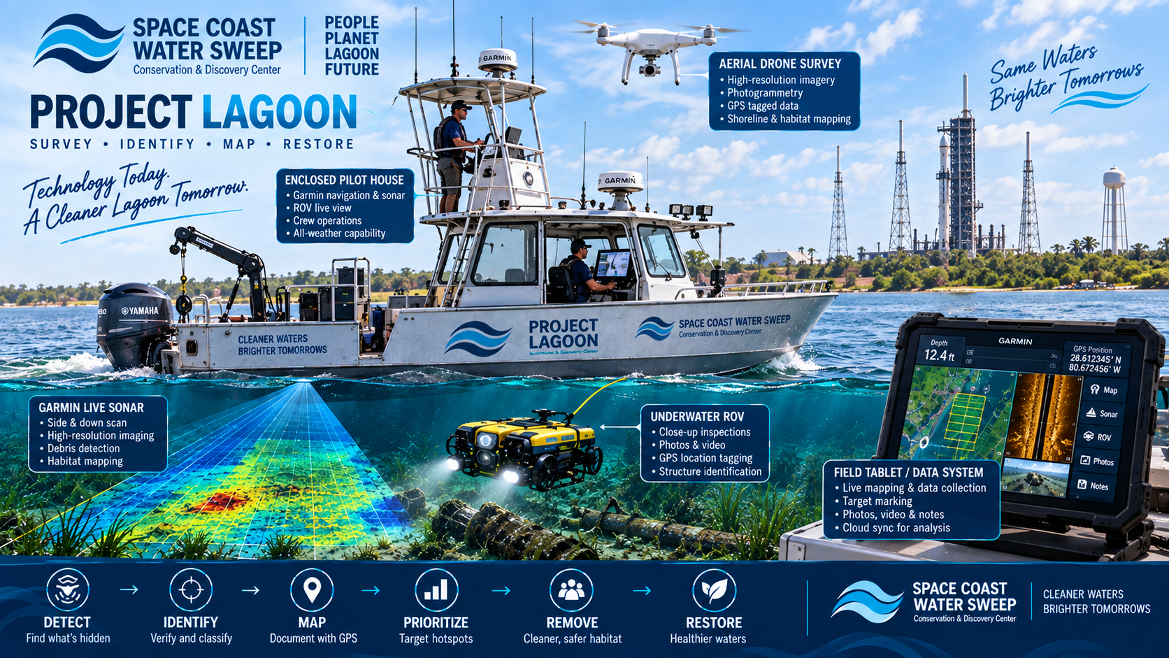
Project Lagoon technology ecosystem for the Space Coast Water Sweep Conservation & Discovery Center — a survey boat with enclosed pilothouse, aerial drone, underwater ROV, Garmin live sonar, and field tablet/data system working together across the DETECT, IDENTIFY, MAP, PRIORITIZE, REMOVE and RESTORE workflow, with callouts for aerial drone survey, field tablet data collection, underwater ROV inspection, Garmin live sonar imaging, and enclosed pilothouse crew operations.
04 — DOCUMENT

If We Find It, We Want to Know What It Is, Where It Is and When We Saw It.

Potential observations may be documented with GPS coordinates, timestamps, survey tracks, photos or video, debris classification, estimated size, condition, environmental context, recovery priority and follow-up status. This allows the program to move beyond anecdotal cleanup.
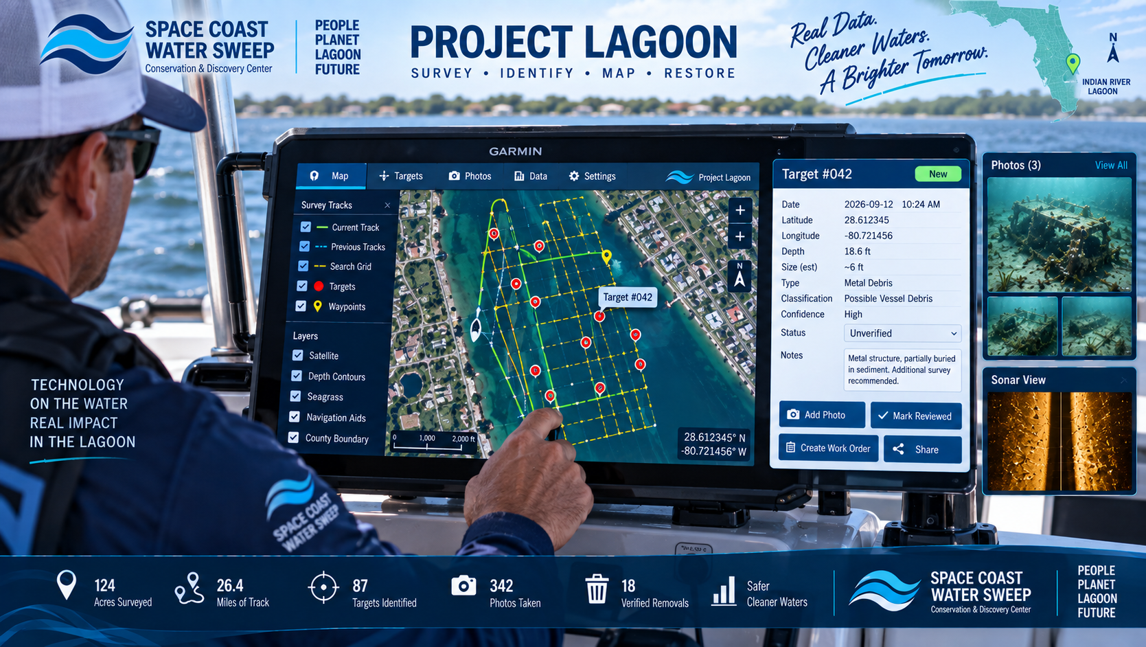
OBSERVATION→VERIFIED TARGET→RECOVERY CANDIDATE→RECOVERED / NOT RECOVERED→RE-SURVEYED→CLOSED / CONTINUED MONITORING
Conceptual field-data interface showing mapped survey tracks, underwater debris targets, GPS locations, photographs, classifications and status information used to document Project Lagoon observations.
05 — PRIORITIZE

Don't Send a Recovery Crew Every Time Someone Sees One Piece of Debris.

Survey teams can continue documenting an area until enough verified recoverable targets are identified to justify a focused recovery mission. Project Lagoon can then dispatch recovery crews to defined target areas rather than searching blindly.
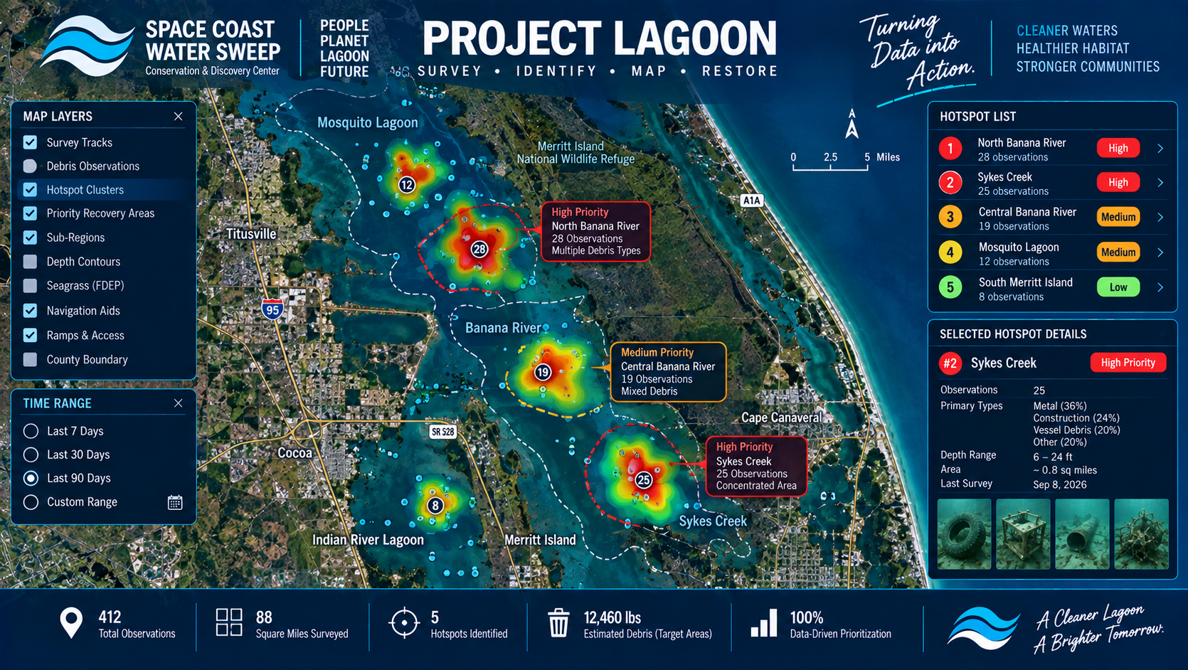
Multiple debris observations
Debris density
Known hazards
Storm-related accumulation
Environmentally sensitive areas
Repeated observations
Operational efficiency
Agency priorities
Conceptual map-based hotspot view showing clusters of underwater debris observations being grouped into prioritized Project Lagoon recovery areas.
06 — RECOVER

Now the Crew Knows Where to Go.

Recovery teams can receive target locations and supporting information before launching. Different debris requires different recovery methods.

Some items may require law enforcement coordination, specialty contractor support, hazardous-material protocol, agency direction, or leaving the object in place.
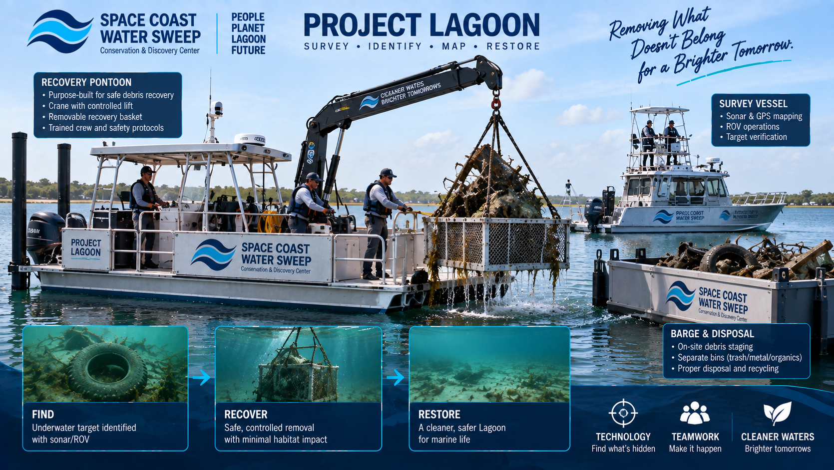
Recovery pontoon
Work boats
Lifting equipment
Removable recovery baskets
Crane or davit systems
Specialized rigging
Barges
Containers
Trailers
Trained field crews
Conceptual Project Lagoon recovery operation showing a purpose-built recovery pontoon lifting submerged debris from the Lagoon using a controlled crane and recovery basket while support vessels and trained crew assist.
07 — PROCESS

Removing Debris Is Only Half the Job.

Recovered material must be documented, transported, sorted and handled appropriately. The future operations campus may support staging, weighing, photography, sorting, recycling, containerization, trailer loading, and specialty disposal coordination.
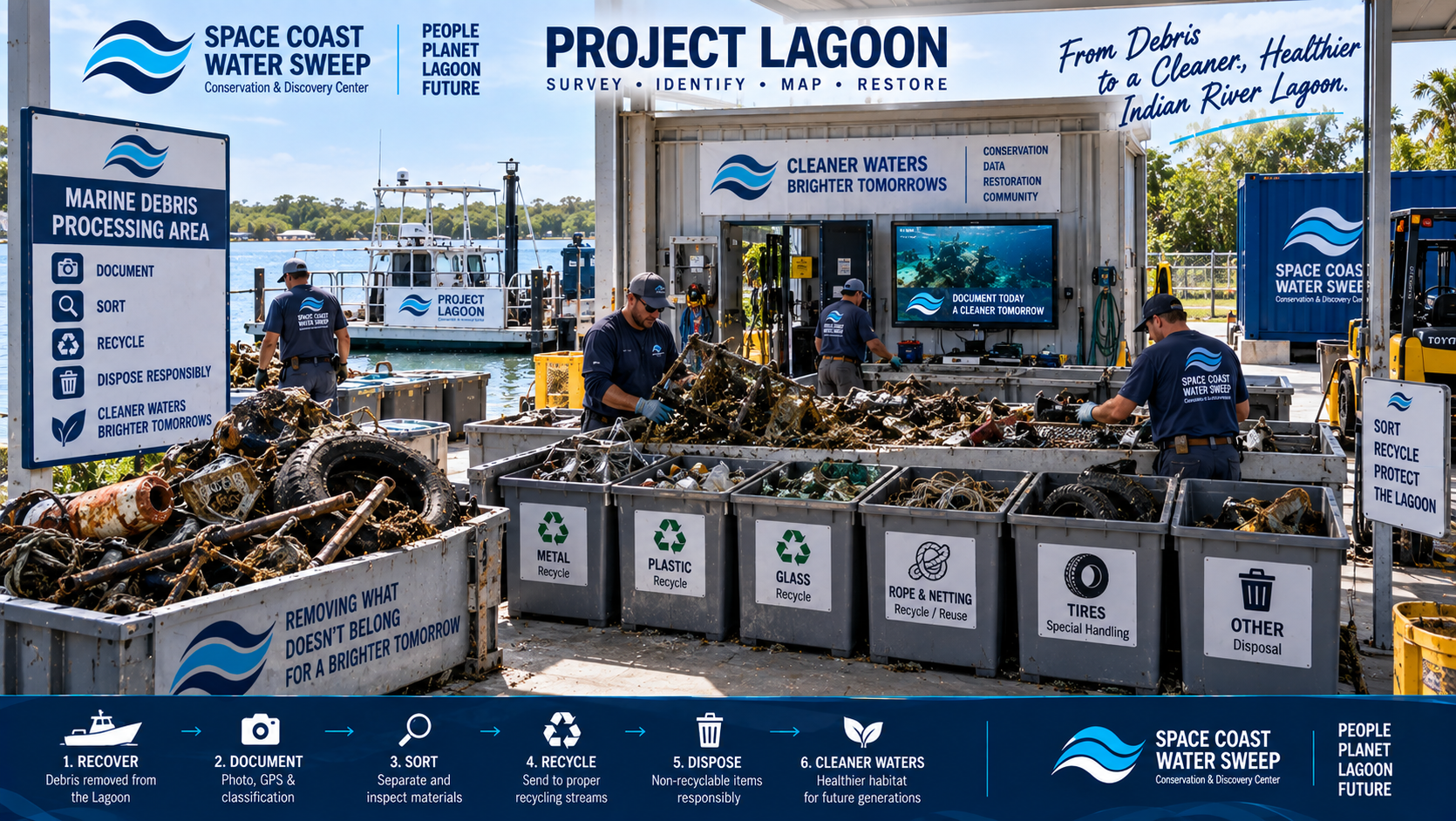
General debris
Recyclable metal
Organic material
Fishing / crab gear
Recoverable reusable materials
Hazardous or special-handling materials where encountered
Conceptual Project Lagoon debris-processing area showing recovered marine debris being documented, sorted into appropriate material streams and prepared for recycling or responsible disposal within a controlled operations facility.
08 — VERIFY

Removal Should Not Be the End of the Story.

After targeted recovery, the area can be surveyed again. Verification can help answer: Was the target removed? Were additional items discovered? Was the area adequately covered? Did debris return later? Is the site changing over time? Does the area need future monitoring?
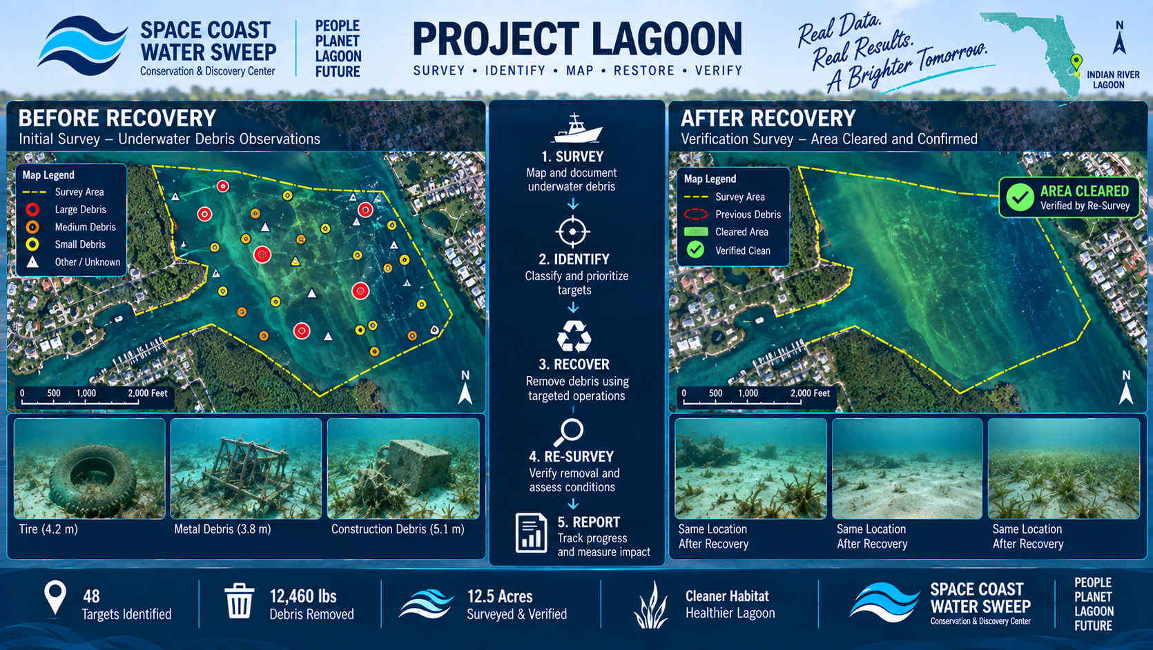
SURVEY→RECOVER→RE-SURVEY→VERIFY
Conceptual before-and-after survey visualization showing a Project Lagoon target area first mapped with underwater debris observations and then re-surveyed after recovery to verify removal and continued conditions.
09 — LEARN

Every Mission Can Teach Us Something About the Lagoon.

Over time, Project Lagoon data may help identify patterns and trends that improve conservation effectiveness.

As the system grows, data connections to Hidden Waters, Currents Through Time, the AI/Data Hub, research partners, university work and environmental reporting may create new opportunities for understanding the Lagoon.
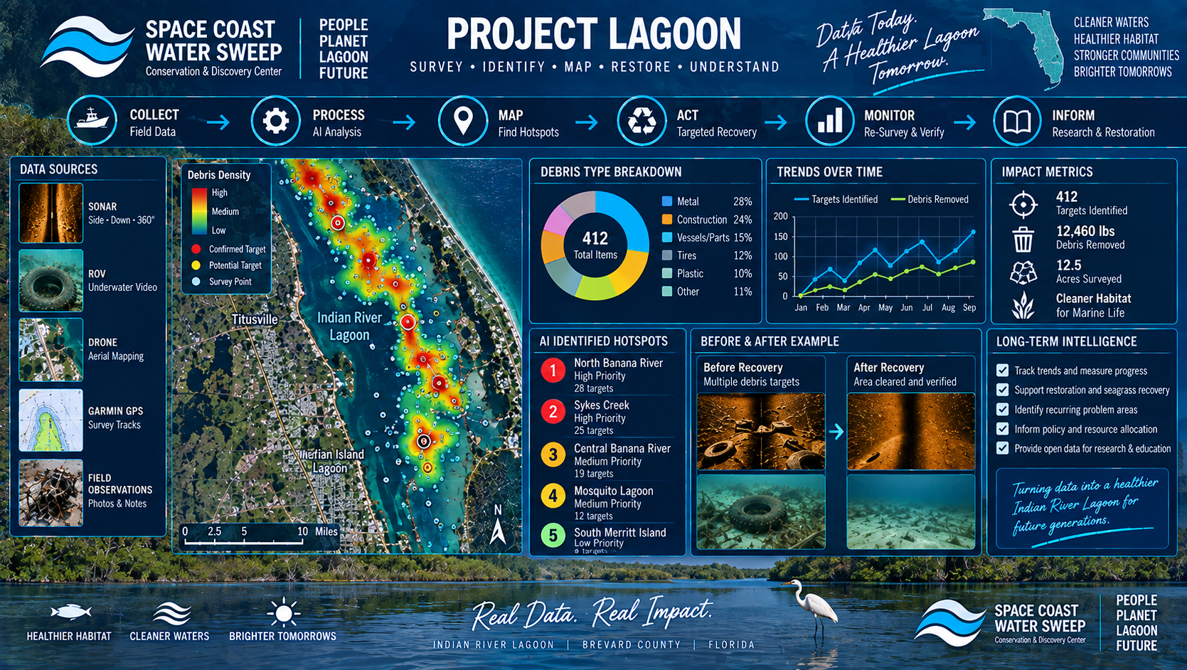
Debris hotspots
Recurring accumulation areas
Storm impacts
Debris types
Recovery trends
Areas needing repeat survey
Environmental patterns
Operational effectiveness
Cost and effort per recovery area
Future restoration opportunities
Conceptual environmental intelligence visualization showing Project Lagoon survey and recovery data contributing to maps, trend analysis, hotspot identification and long-term Indian River Lagoon research.
10 — RESPOND

After a Storm, Time Matters.

The system may also support post-storm or hurricane response. Project Lagoon is positioned as a supporting conservation capability — not a replacement for emergency management, law enforcement, FWC, Coast Guard, county government or other agencies.
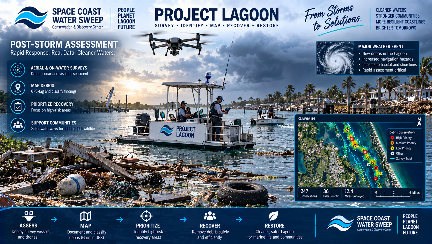
ASSESS→MAP→PRIORITIZE→RECOVER→VERIFY
Conceptual post-storm Project Lagoon assessment mission with survey vessels and drones documenting newly deposited marine debris and mapping priority recovery areas after a major weather event.

From Finding It to Proving It's Gone.

This creates a repeatable conservation system rather than isolated cleanup events.

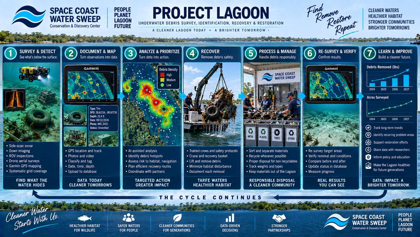
SURVEY→DETECT→DOCUMENT→PRIORITIZE→RECOVER→PROCESS→RE-SURVEY→VERIFY→LEARN

THEN WE DO IT AGAIN.

Polished conceptual Project Lagoon workflow graphic showing the complete cycle from underwater survey and detection through documentation, prioritization, targeted recovery, debris processing, re-survey, verification and long-term learning.
THE HUMAN SIDE

The Technology Helps. People Make the Mission Happen.

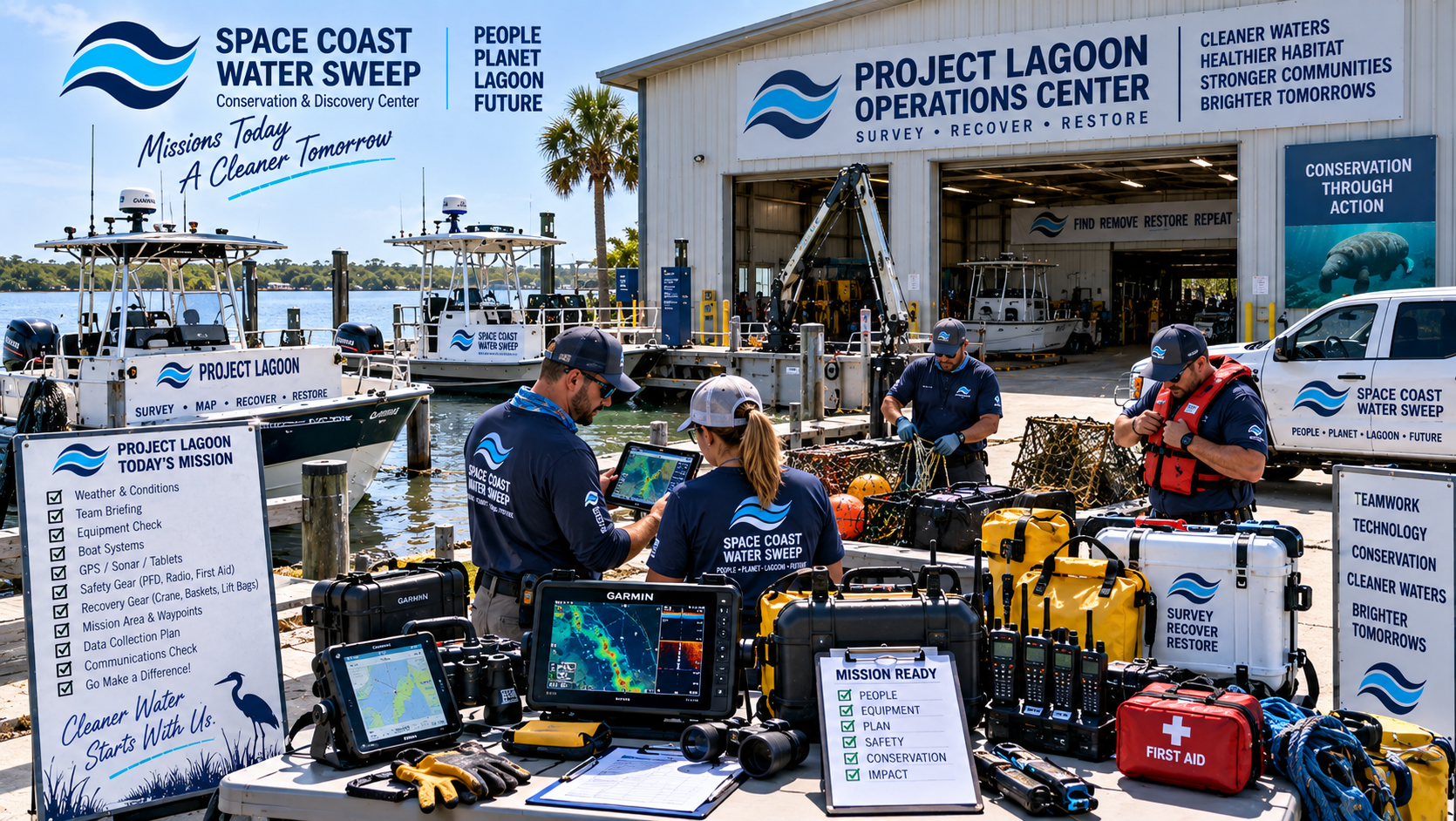
Technology does not replace trained crews, volunteers, partners and field judgment. The system depends on people. The future Center can create a place where all these capabilities connect.
Trained survey crews
Recovery crews
Boat operators
Conservation staff
Volunteers where appropriate
Scientists
Students
Technology specialists
Agencies and authorized partners
Conceptual image of a Project Lagoon team preparing for a conservation mission with boats, field tablets, safety equipment, sonar electronics and marine recovery gear at the working campus.

CONCEPTUAL VISION

Renderings, site layouts, amenities, facilities, costs, locations, timelines and proposed features shown within the Conservation & Discovery Center vision are conceptual and subject to feasibility studies, funding, partnerships, property availability, permitting, engineering and final design.

CENTER
BACK